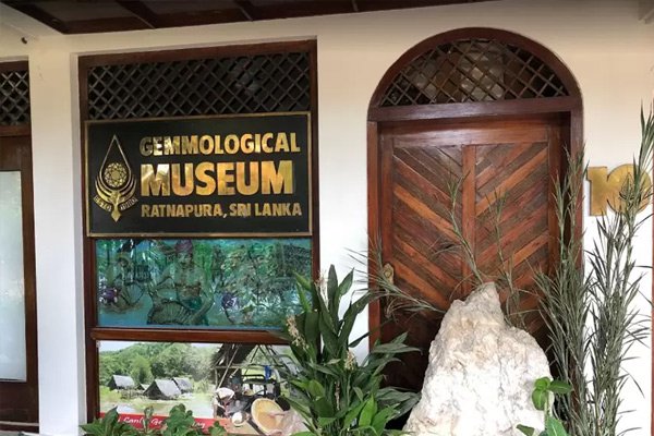
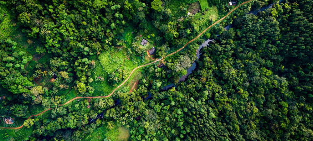
Ratnapura is a major city in Sri Lanka. It is the capital city of Sabaragamuwa Province, as well as the
Ratnapura District, and is a traditional centre for the Sri Lankan gem trade. It is located on the Kalu
Ganga (Black River) in south-central Sri Lanka, some 101 km southeast of the country's capital, Colombo.
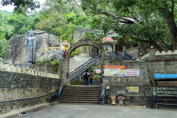
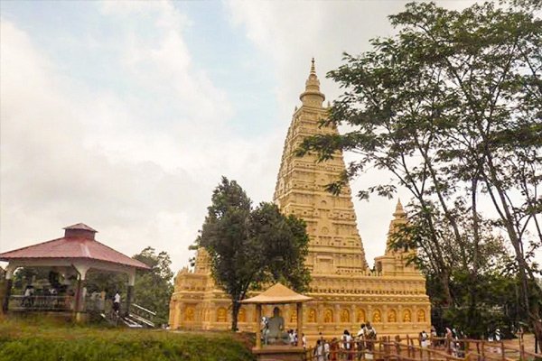
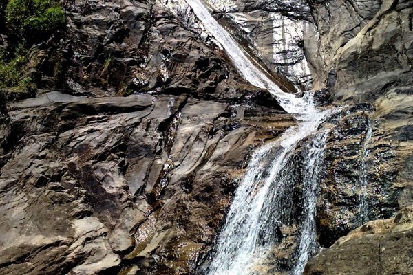
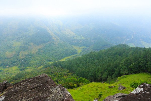
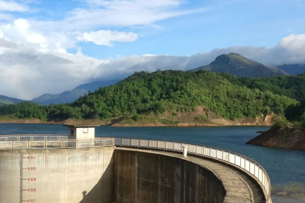
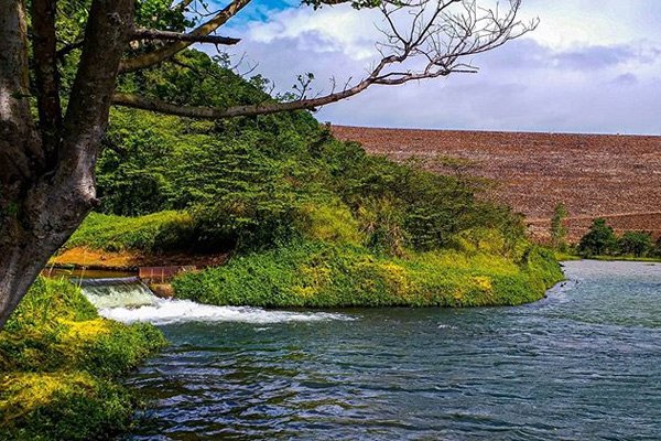
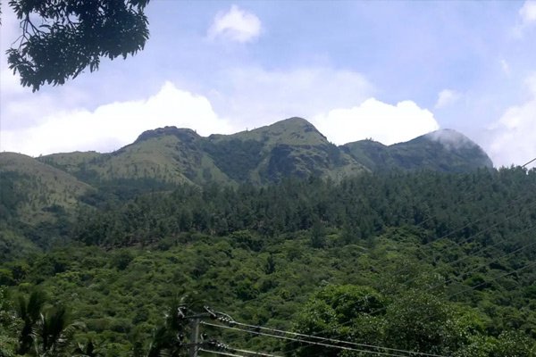
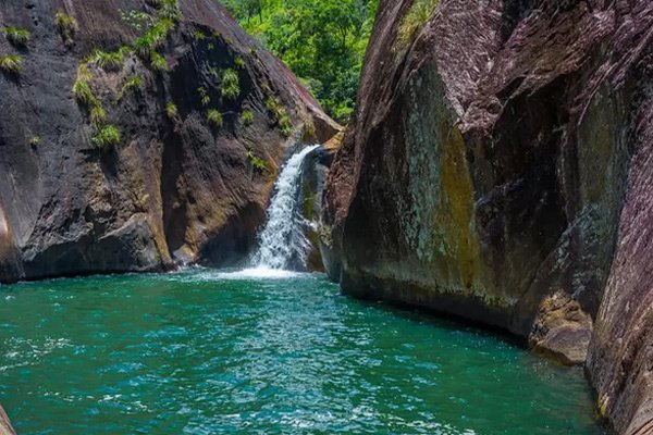
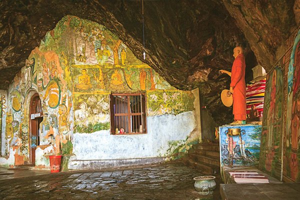
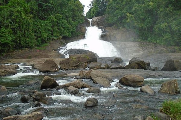
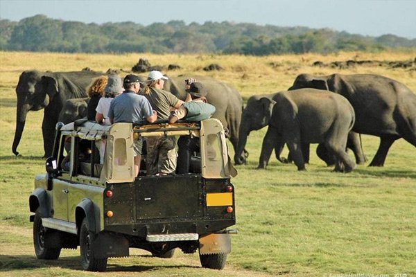
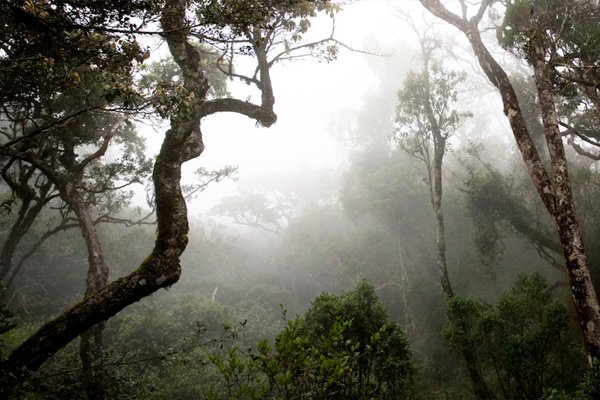
The place is also home to some scenic spots and waterfalls that you would love to visit on your Ratnapura
trip.
Colombo to Rathnapura distance 113.8km
The Ratnapura Gem Museum holds a breathtaking display of samples of precious and
semi-precious stones that include Sapphires, Rubies, and Amethysts. In addition there are
also exhibited pictures, tools and other items that illustrate the history and methodology
of this industry.
Established by a local gemmologist, this impressive private collection of precious stones is
a good place to learn about gem mining in Sri Lanka.
Situated in the Ratnapura district belonging to the Atakalan Korale Thambagamu Pattu
Pallebedda Village the Sri Sankapala Raja Maha Viharaya lies in the outskirts of Ratnapura –
Hambantota main road near the 24th milepost. It is a 5 hour journey from Colombo through
Ratnapura. Sankapala Raja Maha Viharaya stands majestically on a rocky mountain as ample
evidence to prove that this temple has been blessed by the saintly monks who spent their
time in peaceful meditation.
There is evidence that a medieval Balangoda man lived in some caves in the Sankapala temple
premises. There are several legends about this Raja Maha Vihara. King Dutugemunu, who
reigned from 161 to 137 BC, after awarding the battle of Vijithapura, bestowed villages on
his ten great giants. Pussadeva, a giant from the Maligawila area in Moneragala, owned the
village of Palle Bedda. Pussadeva was a master of the archery army of King Dutugemunu’s
army. The Phussadeva giant who accepted this village came to live there with his friends and
built a village. Shortly thereafter, he became disillusioned with life. He was a monk. He
built the Sankapala Vihara. Historical sources also state that Ven. Phussadeva Thero later
became more enlightened.
Dambadiva (Rathganga Asu Maha Shrawaka Pasvisu Rajamaha Viharaya) is located along the
Colombo – Ratnapura – Pelmadulla – Embilipitiya main highway – near Nonagama Junction off
the 22nd km post from Ratnapura. From there lies its turn off along a mountain winding
metalled narrow road running to about 12 km.
It is Buddhist temple which hosts replicas of the sacred monuments found in the pilgrim site
of Dambadiva. The Punchi Dambadiva project has been started in 1981 and currently consists
of the replica of Buddhagayawa, Piriniwan Manchakaya depicting the passing away of Buddha
located in Kusinarawa, a replica of the first dhamma sermon Buddha gave to his five
disciples in Isipathanaramaya and many others monuments.
Surathali Ella Falls is 60m in height, 2m wide and made up of three segments. It is named
after a film that was shot in the area. Originating from the Sri Pada Reserve’s Ellamana
mountain range (948m), the fall is created by the Kadawath River, which flows along
Sabaragamuwa Uva and later into the Weli River. It is bordered by an untouched wildlife
sanctuary.
When you are travelling in A 4 road towards Badulla, there are few kilometers you have to
travel after parsing the famous Belihuloya rest house. There is a name board at the left
site of the road to direct to the waterfall. You have to walk about 50 m to reach there. It
is also possible to reach to the summit of it by following a foot path toward the jungle.
Wangedigala Mountain is one of the Famous Hikers Destination in Srilanka. One of the most
beautiful greeny Mountain with different peaks. wangedigala Mountain is Situated in Colombo
- Badulla Route Near Kalupahana Area (Black and White Bridge) there are few ways to start
the hike, but Kalupahana Black and White bridge way is the easiest and fastest way.
Climbing up Wangedigala is quite challenging, with a steep climb clinging on to tree
branches. When following the walking paths, you might notice that some parts of the trail
even had vanished. Wangedigala is popular for hiking given its cool climate; however, during
some parts of the year, on the way, you might have to see dried-up streams, slippery and dry
paths, and experience high temperature. Therefore, it is essential to pack up necessary
things to prevent you from turning weary.
The Samanala Dam is a dam primarily used for hydroelectric power generation in Sri Lanka.
Commissioned in 1992, the Samanalawewa Project is the third-largest hydroelectric scheme in
the country, producing 405 GWh of energy annually. It was built with financial support from
Japan and the United Kingdom. It is notable for a large leak on its right bank. Power
production continues as planned despite the leakage, and the water from the leak now
provides two thirds of the water issued by the reservoir for agriculture in downstream
areas.
With the availability of irrigated water, the region is now converted into paddy fields and
cash-crop plantations such as sugar cane and banana with corresponding growth of new
settlements.
The Samanalawewa reservoir, formed by a 100m high embankment dam, is one of the largest reservoirs in Sri Lanka built in the recent times. It is located 160km south east of the capitol, Colombo, and is the key element of the 120-million-watt Samanalawewa Hydroelectric Project.
Hike to Adara Kanda is normally the first trip of university students of Sabaragamuwa
University. It will of course be an exciting and amazing hike for all the travelers who love
adventures.
This hike is not an easy one but gives you a wonderful experience you can have in your life
time. Though it is not an easy hike, finding directions is not as hard as in other hikes. It
is better to start early as it takes nearly 4-5 hours to get to all the peaks. We will have
to walk through pine woods and cross water streams. On the way we will also see a monastery.
Pahanthudawa is another unique and beautiful creation among the waterfalls in Sri Lanka,
located approximately 2 kilometers from the little town of Belihuloya on the A4 road, 19
kilometers from Balangoda.
The waterfall is named as “pahanthudawa” as it forms at the base, a pool in the shape of the
wick of the lamp. Reaching the top of the fall itself is quite a hike as it runs through the
jungle but upon reaching its top and enjoying the beauty you will realize it’s never a
waste. The waterfall also powers a small hydro power plant which supplies water for the
locality. The place is ideal for a stop on the way while on long journey and a must visit
for every waterfall lover.
Delgamuwa Raja Maha Vihara is an ancient Buddhist temple situated in Kuruvita of Ratnapura District, Sri Lanka. This temple is reputed as the hiding place of the tooth relic of Buddha during the ruling period of Portuguese in the country. Currently this temple has been declared as one of the archaeological sites in Sri Lanka
The beautiful building known as “Ehelepola Walauva” located at Ratnapura - Colombo road was
opened for the public as a museum on 13th May 1988. It has exhibition rooms which contain
prehistoric archaeological inventions, natural heritage, geological, anthropological,
zoological artifacts and models related to the Sabaragamuva Province.
The weaponry on display include Sinhala swords of the late medieval era including a sword
alleged to have belonged to Ehelepola, and a collection of old guns including a Vickers
machine gun used during the First World War. The cooking utensils of the region include a
tripod pan with three moulds for preparing rice flour cakes known as kiri roti. Traditional
Kandyan jewellery includes necklaces, bangles, anklets and earrings. The grounds of the
museum contain a palaeobiodiversity park, with life-sized animal sculptures of species
believed to have existed in the region.
The Sabaragamuwa Maha Saman Devalaya is considered the main Devalaya of deity Saman except for the Shrine at top of Sri Pada. The history speaks of a temple at Ratnapura area since the time of king Dutugemunu of Anuradhapura Kingdom, But the recent history starts from Dambadeniya period.
The Batatotalena Cave, also known as the Diva Guhava in Buddhist literature, is a cave system in Sudagala, 8 km away from the town of Kuruwita, in the Sabaragamuwa Province of Sri Lanka. The cave measures approximately 15 m high, 18 m wide, and 25 m in length, totalling the internal cave area to 6,800 m³. Accessing the cave involves a 400 m hike from Sudagala, and an additional 50 m climb to reach the cave entrance. In Buddhism, it is believed to be the cave in which the Lord Buddha spent the day after placing his footprint on Adam's Peak, from where he supposedly proceeded to Dighavapi.
The Bopath Falls cascades in the shape of a bo (Ficus religiosa) tree (hence its name) and
is the most comprehensively studied fall in Sri Lanka. Its source is the Kurugana River that
later joins the Kaluganga River at Kurugaomaodara.
Kuru Ganga river, which later joins Kalu Ganga river plunges down in 3 steps to create this
magnificent waterfall. The reason why this fall is very popular among travellers is how
easily it can be reached from Colombo. This is said to be the most comprehensively studied
waterfall in Sri Lanka. The rainfall in this area is usually very high and Kuru Ganga brings
along a massive amount of water from Peak Wilderness Sanctuary, where the sacred Sri Pada
mountain resides. Both falls is famous for flash floods and travellers have been trapped in
small islands around the falls because you can never predict about the water of Kuru Ganga
river.
Udawalawe National Park Being located on the boundary of Sabaragamuwa and Uva provinces of
Sri Lanka. Udawalawe National Park is situated about 200 km south-east of Colombo. You can
easily reach Udawalawa National Park from Colombo via Rathnapura – Pelmadulla – Colombage
Ara – Thanamalwila Road and access to Udawalawe park entrance.
Spot animals such as elephant, buffalo, deer, crocodiles, leopards, and exotic birdlife
among the park’s 119 square miles (308 square kilometers).
Sinharaja Rain Forest (a UNESCO World Heritage Site), the last viable remnant of Sri Lanka’s
tropical lowland rainforest spanning an area of 18900 acres is located within Sabaragamuwa
and Southern provinces of the south-west lowland wet zone of Sri Lanka. Sinharaja is bounded
by rivers on three sides. On the north, Sinharaja is bounded by the Napola Dola and
Koskulana Ganga. On the south and south-west are the rivers Maha Dola and Gin Ganga. On the
west are the river Kalukandawa Ela and river Kudawa Ganga. To the east of Sinharaja is an
ancient footpath near Beverley Tea Estate and by the Denuwa Kanda.
It is home to a vast number of endemic species of birds and mammals of Sri Lanka. About 95
percent of Sri Lankan endemic birds and more than 50 percent of endemic mammals are known to
have their habitats in this Forest Reserve. Year round, the forest is covered by plenty of
rain clouds.